Sunday, October 28, 2012

Waiting waiting...

As I promised a friend that I'd blog updates before/during/after the storm, I've been keeping track of the goings on here in my little spot on the East Coast. Ok, so technically I'm not ON the East Coast. I'm actually about 20 miles west of Chesapeake Bay, 75 miles west of Delaware Bay, and about 100 miles west of the Atlantic coastline. But regardless, my region's supposed to get a lot of wind, and a lot of rain. So, I agreed to document what's happening:

~ ~ Sunday, October 28, 2012 ~ ~


12:11am - I look outside the window and find the tree outside the window blowing ever so slightly. 

12:12am- It stops and starts again for a moment.

1:55am - Thus far in my life, I’ve successfully managed to make mincemeat out of calculus exams, I’ve gotten through Swann’s Way and started the rest of Proust’s In Search of Lost Time, I’ve survived Dr. Sun’s Synoptic Scale Dynamics class, I’ve learned how to stand on my head, and I’ve taught myself how to tie my shoes. I still, however, have not been able to figure out how to reliably get myself to bed before 1am. This is a problem. I looked out my window again as I was crawling into bed and saw itty bitty bits of rain clinging to the glass.

9:25am - I don’t like getting up this late, but I like sleeping more. It’s dry outside. Just like last night, it’s mostly calm, but every once and a while I can see the leaves and branches on the trees sway sporadically.

11:00am - Bullocks to this writing down observations at random times stuff. I’m a scientist by training. I’ll write down my observations at hourly intervals! If something super exciting happens, I’ll make exceptions. It goes without saying that the sky is cloudy. Winds are light, but mild gusts occur occasionally. I can hear the neighbor’s wind chimes going constantly. A band of heavy rain is off to the east, and is very slowly moving its way west. Sandy is still a Category 1 hurricane, and its center is still off the coast of the Carolinas. The most recent NHC advisory has no expected changes to Sandy’s forecast track, and states that it is still possible for Sandy to intensify some as it remains over warm water. The storm is, however, expected to become extratropical (tropical cyclones are warm core systems - heat engines in a sense – that occur in areas of relatively homogenous temperature and get their energy from the heat released when clouds and rain form; extratropical cyclones are cold core systems that draw their energy from the instability created by meridional temperature gradients). 

** SCIENCE ALERT ** Of key importance in forecasting Sandy’s track and where it will ultimately make landfall are two other systems: a center of high pressure off to the north/northeast, and a cold front to the west. The high pressure system to the north/northeast is essentially acting like a wall or barrier, blocking any weather systems heading in its general direction. Meanwhile, the frontal system to the west is associated with a trough, or dip, in the jet stream. Normally this type of feature would push Sandy out to sea as it moves east, but this particular trough is negatively tilted (or tilted to the east; typically a trough would be a bump in the flow: winds coming from the west would dip down and head to the southeast before leveling out and heading back northeast. In a negatively tilted trough, westerly winds will dip southeast, level out, and be forced back to the north and west before they’re able to turn east again). As this trough continued to move east, it will meet up with Sandy and the negative tilt in its winds will pull Sandy to the west/northwest, out of the ocean and towards New England and the Mid Atlantic Coast. (Image from UCAR)


12:00pm - No new news. Still a rain band off to the east. This whole storm thing can really throw you for a loop. It’s not here yet, but you KNOW it’s coming.

1:00pm - See above. I’ve been looking at this on radar for the past… who knows how long: (Radar graphic from UCAR)


Arrrrrrrrggghhhh!! The sky is grey. The neighbor is bringing in copious amounts of firewood. I think I’ll make use of the remaining eggs and butter in my fridge and make biscotti. With butterscotch chips. Also, at this time, I can still hear the flights coming in and out of the Baltimore Washington International Airport.

2:00pm - More of the same. That band of rain I keep on talking about? It still hasn’t moved. *Cue music* Floooooooding on the other side of the baaaaaaaaaayyyyy…

3:00pm - Derr derr derrrr. It appears North Carolina is getting hammered, but it’s more of the same here. Perhaps I shall go to two hourly updates. But while it is not very windy and not rainy, I think I shall pop on out and go get myself those butterscotch chips…

Saturday, October 27, 2012

Frankenstorm's Monster


Hello again, Blog World.

As this collection of bits and bytes accessible to any and all with an internet connection will attest, in the past I have traveled many many miles in order to experience, study, and observe inclement weather. After one particularly awful birthday, I left my last weather venture (ROTATE 2012) early in order to relocate myself to the East Coast of the United States of America. And now, wouldn't you know it, it appears that the inclement weather may be coming to me.

That's right folks, on October 22, 2012, the eighteenth tropical depression of the season was christened "Sandy" and began to stroll north, stepping on Jamaica, Cuba, and Haiti before setting its sights on the Bahamas and the open ocean. It churned and churned and churned past Florida and as I type, its center is off the coast of the Carolinas as it undergoes a freakish transformation from tropical system to extratropical monster. Indeed, Sandy’s moniker “Frankenstorm” has nothing (ok, almost nothing) to do with the fact that the storm is occurring close to Halloween, nor does it have anything to do with the fact that you can see the heavily scarred and disfigured visage of a madman’s science experiment in Sandy’s satellite imagery if you squint your eyes and look close enough.  Oh no, the name “Frankenstorm” first appeared in an HPC discussion on October 25th, where forecaster Cisco mentioned that it would be a “GHOULISH NICKNAME.” (NOAA forecast discussions are generally all in caps. They also make heavy use of acronyms, which can make them difficult to read.) The fabulous FunnelFiasco has archived the discussion in question here. As you can see, Sandy was dubbed “Frankenstorm” because it was expected to become some freakish conglomeration of different storm parts, melded together to form a monster storm, like the reanimated body of some cold corpse; unnatural and shunned by man because they cannot understand its gargantuan stature or gruesome appearance.

(Literature aside: Contrary to popular belief, Frankenstein was not the ghoulish monster we’ve come to know and love with pale, pasty skin and battery terminals embedded into its suture laced neck. Frankenstein was instead the man that created the monster of which I speak; some mad scientist obsessed with the idea of bringing a body back from the dead. He never gave the monster a name, nor were we ever told what exactly the monster looked like. Instead, we were shown an initially kind and articulate creature who only wished to be loved and accepted, but who was despised and turned away by all, even his own creator, because of his hideous appearance. The trauma of constant rejection caused him to become slightly sociopathic, and he went on a crusade to make his creator suffer as much as humanly possible by destroying all of the people Frankenstein held dear. And to think, all the monster really wanted was to be loved!)

I look out the window now and it is calm. This won’t, however, last for long. I expect the rain to start some time while I sleep tonight, and tomorrow things will likely get windy. I plan to blog this experience, and if the power happens to go out while Sandy passes by, I’ve promised my friend Derrick (atmospheric science grad student and occasional contributor to weather stories at Lafayette, Indiana’s Journal and Courier) that I will continue my blogging in an old school manner: with ink wells and a glass pen.

(I’d also like to say at this time that I don’t think I’ll be driving to Kansas to escape the storm, and that I seriously doubt that Kansas has cupcakes that can rival the likes of which I have found at my favorite cupcake shop here.)


Sandy and the Great-Big-Late-October-Cold-Bringer, as seen by the NASA GOES-13 satellite on Friday, October 26, 2012. I can't think about this storm without getting the Evelyn Evelyn song, "Sandy Fishnets," stuck in my head. Image source - http://www.flickr.com/photos/gsfc/8125127055/in/photostream


Even though the heart of Sandy is still several hundreds of miles away off the coast of the Carolinas, it's cloud shield was still overhead today. Standing facing the horizon are three sentinels of that vast and "advanced" network of cables and wires that brings power forth from the depths of the earth and eons past and delivers it to your home so that you may pop fresh popcorn for your weekly movie nights. In the distance, Sandy whispers a grim promise to these sentinels that is carried on the wind to their innocent, metaphorical ears. "I'll get you," she says. "Beware, for I'm coming, and by the time I am gone, none of you shall stand!"

Saturday, May 26, 2012

End Of My Season

May 25, 2012. The day started at midnight with off key singing and stories and camaraderie. And that was beautiful.

After sunrise, the armada woke up in Lawrence, Kansas to thoughts of pushing a little farther west. Convection wasn’t necessarily a given, but if clouds were to break the cap, the ingredients were there for them to become supercellular. And well, they kind of did:


Now, those are the kind of storms that CSWR likes to see. After several days of largely uneventful weather, ROTATE was able to observe and collect data on a few tornadoes in western Kansas. Unfortunately, a couple of the vehicles found themselves a little too close to one of these tornadoes and sustained some damage to themselves and to their instruments. Thankfully, however, all occupants of those vehicles, as well as all other members of the CSWR team and a woman whose home was destroyed in the vicinity, made it through the storm with little to no harm. Kind of puts a whole new spin on intercepting a tornado…


In all that exists in the world, storm chasing is but of its own little microcosm. Unfortunately, life does not stop for the chase. I had to depart from the project on the morning of May 25, 2012 to make my way back home and back to real life. I’d like to give a big thanks to all of the CSWR crew (past and present) for being such great individuals. It is hard enough as it is to live out of a suitcase for weeks at a time while constantly worrying about whether you are eating enough greens. It would be nearly impossible were it not for the amazing people you get to share that time with. Miss you all, and hope to see you soon.

PS- You’re welcome, Josh.

We are ROTATE2012. Well, half of it anyway. In no order: Mareike, Maryam, 
Chris, Ronan, Taylor, Herb, Melissa, Lindsay, Rutger, Eric (Not Tim), Alycia,
Rachel,  Brian, Eddie, and erin. Photo by Melissa Guzinski. 

Thursday, May 24, 2012

Status Status!

 Believe it or not, it’s actually been a rather busy week for CSWR. Since the last post, the armada has gone from Kansas to South Dakota to North Dakota to South Dakota to Iowa and Nebraska. Given that two of these three days have been active mission days, mornings have been rather early, sleep has been rather limited, and breakfast has been rather elusive. A chase in North Dakota yielded little other than some views of a picturesque landscape and the sighting of a single, weak, brief tornado. After cutting our loses there, we headed down to Nebraska, where the chase provided us with some weak gustnadoes and some ominous looking scud (stratocumulus under deck) clouds. Our DOWs and mesonets were able to collect some data on the storms we did see, but the perfect storm with the perfect tornado still remains to be seen.

Sccccccccccccccud!

Since, however, it would be gloomy and depressing to leave this blog post on that note, I figured now would be the perfect time to explain a little bit about how we, as chasers and research meteorologists, live while we’re out here on these field projects. (Apologies if I've made a post like this before... it was late and I was exhausted...)

Being on a project like VORTEX or ROTATE is certainly a unique experience. A CSWR field scientist essentially spends their time on a project living out of a truck and a suitcase. The typical day involves getting up early enough to be packed (hopefully showered and fed) and ready to leave by 7-10am Central Daylight Time. It doesn’t matter if the town we happen to be staying in at that moment is on Mountain Time; since tornado alley is mostly in the Central Time Zone, all of our operations simply take place going by central time (even though all of our observations are recorded in UTC).

After packing up all of our things and our vehicles, the armada typically leaves and heads to or towards some pre-determined target that was identified either that morning or the night before based upon observations and where the weather models are indicating that conditions might be ripe for severe weather. On some days, this initial target can be sixty or seventy miles away. On others, this initial target can be upwards of three hundred miles away. It is therefore definitely not unusual for drivers and passengers to start losing feeling in their legs and/or rear end while the day is progressing. The only stops typically permitted are those stops for which the expressed purpose is to use the facilities, get gas, or pick up food. More stopping? Hah! Forget it!

If we’re quite lucky, the initial target area will be somewhere where individuals have the opportunity to grab and eat lunch. More often than not, these opportunities only arise in areas where the food options are largely limited to Subway and Subway. The day’s initial target area is generally in a location where the lead scientists and forecasters on the project can analyze the information they have available to them and leave rather quickly and easily to another target area somewhere (relatively) close by. Some days this next target area can be five to ten miles away. Some days it’s more like one or two hundred. And some days the next target area is in the same city as the previous night’s hotel. Now that usually stings.

Eventually, after this hurry up and wait process has taken place several times, convection may spring up and we may have a chance to actually chase a storm. At this point, a new sort of hurry up and wait process begins. The armada hurries to the location or in the path of a possible “area of interest,” and waits whilst the DOWs (or at least DOW7!) run scans and evaluate the situation. If things look good, we’ll stay on a storm and hopefully deploy more instruments. If things look bad, we’ll either abandon the storm and search for another, or reposition ourselves to keep ahead of an “area of interest” that just may need more time evolving. If things look really bad, we’ll skip wasting our resources and risking hail damage to retreat to the evening’s lodging, which, if we’re lucky, will be lined up before we stop the chase (we almost never actually know where we’ll be staying on any given night; hotel information isn’t obtained or revealed to us until at least the late afternoon hours).

If a scientist’s vehicle has managed to make it through the day functioning, then that vehicle will drive that scientist to the evening’s hotel, which may be thirty minutes away, or upwards of four hours away.

The next morning starts a similar day. Lather, Rinse, Repeat.

Off to Kansas/Missouri now….


We're going crazy. CRAZY!

Sunday, May 20, 2012

These Are Not The Tornadoes You’re Looking For…

One perhaps little known detail of storm chasing is the fact that, when you are chasing for  prolonged period of time, you often tend to forget what day it is, what you have done, and when you did it. If you had told me just a few hours ago that it was Saturday, I would have scoffed and said “I don’t believe you.” This past day was, however, Saturday, and to set the record straight before I completely forget or get mixed up, I have to report that on this Saturday, we got out of Dodge. Dodge City, that is.  The SPC had a slight risk area marked up in Kansas, Nebraska, and Oklahoma, so we headed east out of Dodge City towards the region where convection was forecast to have the greatest chance at being severe. The chance for tornadoes was marginal, but when you’ve had the season we’ve been having, you will latch on to any chance (within range, of course), you can get!

Needless to say, we didn’t get too far out of Dodge before the almighty PIs (the acronym, not the irrational number) hand picked the Walmart parking lot we’d be, well, parking ourselves in for several hours awaiting any sign of inclement weather. Lunch time (for those who ate lunch) came and went, the TIV came on by and stole our thunder, but still the weather looked bleak. Convection did spring up, but as it looked like it was quickly becoming linear, we didn’t expect too much would happen. Well, I’ve got to say WE WERE WRONG!

The armada actually saw a handful of tornadoes today. They were visually rather unimpressive, but they were in fact tornadoes. Given the tornadoes’ presentation on radar and the fact that the armada was not in a prime location with respect to them, the poor pod people spent the day confined to their vehicles, having to be content with getting by with only mesonet data. The hail we were getting may also have something to do with this… No wind shields were broken, but I certainly wouldn’t want to go outside to deploy pods when little ice balls an inch or so in diameter are being hurled at me at at least terminal velocity by the sky. The DOWs, however, got data.


Near Harper, Kansas. This tornado actually persisted for some time and did some damage...


... Like potentially to this wind turbine. Poor wind turbine.
 
Another perhaps little known detail of storm chasing is the love hate relationship you develop with Walmart and their parking lots when you are out in the middle of nowhere on the Plains...


Thursday, May 17, 2012

Hanging At The Hangar

That's right, folks. We're back in Boulder. Again. We can't help it, really... ROTATE 2012 is on a budget, and, quite frankly, it would probably just be costing too much money to be out and about in the field when we have this to look forward to:


Yeah. It's rough. But, just because we're not actively chasing at the moment does not mean we're actively down or that there aren't things that still need to be done. "What," you may ask, "do these storm chasers do when there aren't any storms to chase?!" Well, it must be your lucky day, because I figure I might as well tell you:

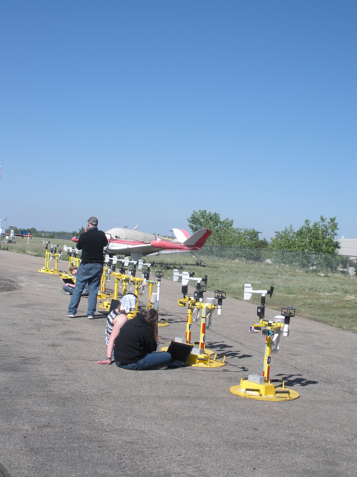
First off, see all of these things?


Well, sometimes they don't work.When we drive these vehicles out in the field, they can easily get 600 or so miles put on them in a day, and they may have over 100,000 miles on them already. Of course they'll have the occasional mechanical problems. On top of that, they're all wired with instrumentation, which is itself susceptible to wear, tear, and general malfunction. The DOWs themselves can be especially prone to problems; they are wonderfully fabulous pieces of equipment, and data collected by them are invaluable to the advancement of the understanding of certain atmospheric phenomena, but they are machines with moving parts and advanced hardware and software. Programs crash, computers lose communication, and motors wear out. It takes a lot of skill and effort to keep a mobile Doppler radar in good working order.

Next, we have these:


Like the vehicles, tornado pods are also susceptible to problems. Generally speaking, the pods won't deal with the same wear and tear that the vehicles and their mesonets will deal with, but they can experience hardware or instrument problems, and the software used to communicate with them can have issues. Almost every time a pod needs an instrument replaced or has to have its data logger (the thing that actually records all of the data) examined / worked on, the pod needs to be "cracked open" and otherwise disemboweled. It's gruesome, I tell you.


These days are also used to do such things as improve vehicle radio communication and internet access, practice some of the every day tasks that would be assigned on active chases, and to generally gain a better understanding of the vehicles and equipment that will be used. Cookies also may or may not be consumed. But this depends entirely on the availability of good cookies.

Editor's note: The photographic images in this entry are entirely anachronistic. Though they do represent some of the every day tasks at CSWR, they are from the time period before I got tired of carrying my little point and shoot digital camera around the hangar. Yeah... that was like four whole days ago...

Monday, May 14, 2012

On The Road Again Again

The dismal days have come and gone, leaving in their wake dreary, dusty memories of times once passed, roads once traveled, and storms once seen. Five days we spent in Boulder; five days we watched the clouds float by with nary a sight nor sound of convection to come. Despondently we hung our heads and wrung our hands; with melancholy eyes we perused the forecast discussions and analyzed the model runs, but the guidance horizons showed us little to no glimmers of weather hope. Work is work, however, and worn hands still slaved away over hot grinders and hollow wave guides.

Alas, a small beacon of light appeared and shined itself down upon our weary party. The SPC, that wise and awesome juggernaut of severe weather prediction, determined forthwith that conditions might be favorable for tornadic convection in the land of the arid southwest. The outcome was bleak, but with no other options presenting themselves in the near future, our band of wayward travelers packed up their things and migrated to New Mexico…

At this point in the story, you might expect a *bang!* *smash!* *tornado!*, but such was not in the cards (or, quite literally, the atmosphere). New Mexico did see storms today, and they may have even been severe, but the ingredients simply were not there to produce much in the way of tornadic activity. The armada therefore spent much of the day in Carlsbad, New Mexico interacting with the public, meeting up with Sean Casey’s TIV to make sure that its instruments were wired correctly, posing for photo ops, and getting to know our DOW8 driver’s (Eddie!) hometown and family. We did observe convection forming near the area, and many of our group either got photos of the storm as it was becoming outflow dominant or of its lightning, but the DOWs and Scouts themselves could only experience the storm’s gust front and downpours from the hotel parking lot.

Conditions for the rest of the week still look rather bleak. You know what that means…


Imagine pulling up to your local WallyWorld and seeing this in the parking lot.
 

 ... or this.


Friday, May 11, 2012

Chasing Carnadoes

May 10, 2012. The two year anniversary of May 10, 2010. But let’s not think of that day...


Today was the sixth full day of ROTATE 2012. It was also the sixth full day of ROTATE 2012 with virtually no “interesting” weather anywhere in the ROTATE 2012 domain. And since there also appears to be virtually no “interesting” weather anywhere in the ROTATE 2012 domain for the near future, a CSWR colleague at the National Weather Service has chosen to reassign the ROTATE acronym to a different phrase, namely the “Ridge Over Tornado Alley and Tanning Experiment.” At least when times get rough you know you can count on your friends!

Fortunately for the project (but unfortunately for yours truly, who must leave ROTATE early), this unfavorable weather comes at a good time. A trip to Sioux City, Iowa on Day One revealed several problems with our vehicles and instruments, and some down time has actually been needed to address and fix the issues. Another plus of having this time is that *surprise!* we actually got a chance to do a practice deployment before we missed any chances with the weather. Now, you may ask “how exactly does one do a practice deployment for a fully nomadic three DOW, six probe/scout, twenty two tornado pod project?” Well, the answer is quite simple, really: We deploy generally as we normally would in the presence of a tornado, except we switch the tornado out for a burgundy SUV. And thus a carnado is born.

The dynamics of carnadogenesis have remained a mystery to atmospheric scientists since the first major thunderstorm and tornado-related field campaigns took place. It can happen suddenly and may or may not occur at a predetermined location. There is little consensus as to which vehicles are most likely to produce carnadoes, so this phenomena is not yet well warned by any local or national agencies. It is, however, thought that most carnadoes that occur in the Boulder, Colorado area do indeed originate from Subaru SUV or crossover vehicles (a similar van-nado is believed to be born from white Enterprise rental cargo vans). More data are necessary. Any other questions are beyond the scope of this research.

In any event, our first practice deployment went as well as could be expected in the present situation. The observed carnado spun along at a leisurely 20mph, and most of our scientists did manage to deploy their instruments and get out of its way and into safety in ample time to avoid damage. Carnado dynamics will not remain a mystery for much longer…


 New Scout3 / old Probe11 and DOW8 (the rapid scan / old DOW5) await deployment instructions

 
This is Herb. Herb makes and fixes things. Without Herb, at least half of our vehicles and instruments this season probably would not work. Thank you, Herb. Kudos also to Justin, Andrew, Ab, Brian, and everyone else who has helped out a lot (or even a little!)


(Note to readers: Any nonsensical nonsense contained herein is a product solely (mostly) of my fatigue and the fact that I’m presently sitting in a hotel room that I really don’t wish to sleep in without a hazmat suit.)

Sunday, May 6, 2012

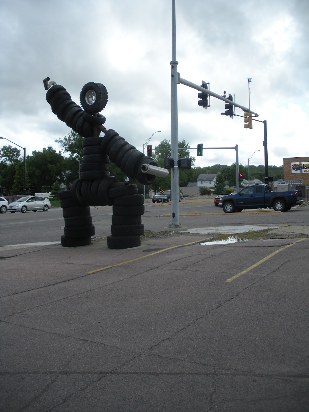
TIRE MAN!

Tire Man
(Liberally adapted from lyrics originally written by F. Iommi, W. Ward, T. Butler., and J. Osbourne.)
(Inspired by Sioux City, Iowa.)

I am Tire Man!
Has he lost his grip?
Can he even last this trip?
Can he drive at all
Or is he running bald?

Is he full of dread?
Saw his brother blow his tread
Wurman left him there
Will Herb toss him for a spare?

He turns with the wheel
Until his tread begins to peel
When he traveled roads
In search of great tornadoes

Nobody wants him
He just sits pavement bound
Waiting for the storms
Waiting for rain to pound

We can’t keep him now
He won’t work for the DOW
Perils of the road
Taunt the radars he once drove

Nobody wants him
They just drive on by
Nobody helps him
He’s a road hazard now

Heavy rubber treads
Fill the traffic full of dread
Driving as fast as they can
Tire Man lives again!


Bohica! The ROTATE armada is Boulder bound, en route to make repairs and celebrate* our "1st clear air bust of the season."


* Sarcasm.

Saturday, May 5, 2012

On the Road Again...

Greetings, e-people. Welcome to the blog post. It’s now Saturday, 5 May 2012. After days (and nights, for some) of intense preparation, the ROTATE armada left its Boulder hangar home during the earlier hours of this morning. Initial target: Eastern Nebraska. Vehicle status: somewhat operational.

** Break for DOW7 story time and a history lesson on I-80 and the Platte River **

Speaking of DOW7, I suppose I could introduce you to the ROTATE armada. Out for CSWR this season are:

DOW7. The DOW in charge. It’s a dual polarization radar. It’s also responsible for story time and history lessons. It was formerly responsible for the puns. (We miss you Jeff!)

DOW6. Also a dual pol radar. Former seat of Justin Walker and his banjo. We miss you Justin!

DOW8. The New oldKid on the Block. DOW8 is a rapid scan radar (read: it scans things fast!), and used to be DOW5. Like a phoenix, it rose triumphantly from the dilapidated remains of the DOW5 chassis.

Scout1. It’s new, it’s blue.

Scout2. It’s new, but not blue.

Scout3. Formerly Probe11. It’s most definitely not new.

Scout4. Formerly Probe12. Home of yours truly for the next three weeks. It’s full of dog fur. Not that that’s a bad thing…

Scout5. The cargo van. It’s very very important; it lugs around all of our food, supplies, and suitcases.

Scout6. Formerly Probe14. Also known as “White Lightning.” This is Tim Marshall’s domain. Need I say more?

The MORC. Nanoo Nanoo.

(I’m kidding, I’m kidding. The MORC was the MOC, or Mobile Office Center, before they added in an ‘R,’ which stands for something that is escaping me at the moment. The MORC is a big, white Mercedes Benz, and was literally created to be a mobile office. Due to the awkward weight distribution in the MORC, it is practically incapable of driving in a straight line.)

M1. It has a puppy. She’s adorable. M1 makes a lot of pit-stops. For the adorable puppy.


And that’s it. All of the DOWs have radars (of course). All of the Scout vehicles have mesonets and tornado pods… each Scout vehicle, with the exception of Scout5, has four tornado pods capable of measuring temperature, humidity, wind speed, and wind direction (Scout5 has two pods). So, that should be twenty two pods total. If we’re successful, some of these pods will be placed in the path of a tornado, and will collect data on that tornado at ground level, where scientific data on tornadoes is rather sparse. This data can then be used, in collaboration with the dual Doppler radar data we hopefully also collect, to better understand what exactly is going on in a tornado at the ground level. Pretty cool, eh?

PS- … we miss you Justin!!

Friday, May 4, 2012

packpackpack

Here we are again, folks. It’s springtime, and you know what that means, right? The chase is once again upon us. 2011 saw some impromptu outings from CSWR, but with no pre-planned project, yours truly did not participate. This year, however, is a different story, and ROTATE 2012 (Radar Observations of Thunderstorms and Tornadoes… I think) has been on the docket now for months, with a planned May 5 start date.

Now if you’re any of the thirty or so people who will be joining CSWR on this little adventure (or if you’re anyone who’s basically lived like a nomad out in the boonies for several weeks at a time), you probably already know how to prepare. If you’ve never in your life even imagined undertaking such a trip, you’re probably thinking “how the hail does someone pack for something like that?” Well, since I’m on this plane to Denver for another hour and a half and all I really have to do is sway to the turbulence while watching some muted Katherine Heigel film and listening to the music emanating from the earbuds of the soon to be deaf guy sitting next to me, I might as well tell you.

When you’re packing for an epic road trip, the key is to be prepared. You must keep in mind that nearly all of your basic necessities for the next six to seven weeks (or three, in my case), must fit into a small suitcase or duffle and a backpack. While it may be true that you’ll arrive at your destination and find nearly everyone in your party has packed their things in a much bigger suitcase or duffle than you, it doesn’t matter. You’re a road warrior! You scoff at the thought of checking baggage on flights! (Ok, with the exception of your liquids and gels, because some spoil sports out there thought it’d be a neat idea to attempt to blow up planes with gel-like explosives. I grumble in their general direction.)


EPIC METEOROLOGICAL RESEARCH ROAD TRIP PACKING CHECKLIST

- Underwear. This is very important! You wouldn’t want to be stuck in Themiddleofnowhere, Nebraska with no clean knickers, would you? Yeah, didn’t think so.

- Clothing. Almost as important as underwear. Expensive clothing is not recommended, unless you want it to get destroyed. Pantless chasing, however, is not an option.

- Shoes. Make sure to remove them at airport security. High heels are not recommended. Neither are Prada flats. Jebus shoes are optional.

- Toiletries. Shampoo, conditioner, toothbrush, toothpaste, deodorant, floss… all important. Just because you’re living like a nomad doesn’t mean you shouldn’t pay attention to your personal hygiene. Really. Your vehicle-mates will thank you.

- Hand sanitizer. You’ll need it.

- Sunblock. What better place to get a sunburn than sitting in a truck stop parking lot during peak hours?

- Sunglasses. Cheap ones. Expect to sit on and break them.

- Rain gear. Believe it or not, you may be working in inclement weather. If you’ve never had to sit in a car for several hours soaked to your skin, believe me when I say that it’s not a pleasant experience.

- Medications/supplements. First off, migraines and other maladies don’t stop just because you’re traveling. If anything, the dehydration, poor nutrition, and sleep deprivation that come along with chasing will probably exacerbate them. Second, since the dehydration, poor nutrition, and sleep deprivation that come along with chasing do wonders for your health, your body and immune system can use all of the help they can get. Multi-vitamin anyone? Shingles vaccine??

- Food. Speaking of poor nutrition, if you can pack some good food, more power to you. Portable and non-perishable protein and fiber are great. Future road trip roomie, Mallie, told me she was bringing along individual packets of Justin’s almond butter. I stole the idea.

- Gum. To keep yourself from eating all of the food you packed out of boredom on your way from Colorado to Iowa.

- Camera. Memorrrrrriiiiiiiessss.

- Your portable electronic devices. Because.


Also keep in mind that regardless of how well you’ve prepared, you will probably forget something. I probably forgot things on this list. And I totally just realized I forgot to pack [at least] three things I was planning to bring. Oops…

Sunday, May 1, 2011

Resurrection

It happened.

You heard about it.

Maybe you even saw it.

Maybe you’ll never be the same.

They started several days ago, the storms. They travelled across the central, southern, and eastern parts of the country in waves; one after another. At one point they even had the U.S. adorned with tornado watches that extended all of the way from northern Michigan to the southern Texas. We knew it would be bad. But few would have guessed it would be like it was.

The events of Wednesday April 27, 2011 will reverberate through the towns of the southern United States for many years to come, and they will likely reverberate through the meteorological community for decades. As meteorologists, many of us watched in horror as we saw live feed of the tornadoes going through Tuscaloosa and making their way to Birmingham. Many of our number sacrificed rest that night in order to continue to put out the watches and warnings that would hopefully notify the public they needed to find safe shelter. Many more stayed awake in order to ensure that friends and family were taking the impending threat seriously and finding safe quarters in which to sleep. We all hoped that these efforts would not be in vain, but when the sun rose the next day and cast light on the damage and casualties, many couldn’t help but wonder if things could have been done better, or if something might have gone wrong.

Meteorologists knew days in advance that conditions would likely be favorable for severe convection across much of the country in these last few days of April 2011. As April 26 and 27 came closer, forecasts were able to become more precise. On Monday, April 25, the Storm Prediction Center (SPC) issued both Day 2 and Day 3 convective outlooks that indicated a moderate risk of severe weather potential over parts of Dixie Alley. By 13:00 UTC (9:00 am EDT) on April 26, the SPC had issued a high risk of severe weather potential over parts of Texas, Arkansas, and Louisiana and indicated that there would be an elevated threat of significant tornadoes (of damage intensity EF2 or greater) for the rest of the day in and around this area. As the day went by, the high risk was extended east to include parts of Mississippi. It should be noted that the severe threat was also indicated as being present over much of the rest of the southeast. Preliminary storm reports suggest that the tornado outbreak started in earnest around 22:00 UTC (6:00 pm EDT) in northeast Texas, about 9 hours after the SPC had issued a high risk for the potential of severe weather. The first tornado watch on this day was issued for northeast Texas, southwest Arkansas, and northwest Louisiana at 18:45 UTC (2:45 pm EDT) and was in effect until 10:00 pm local time. This watch was also the first of three Particularly Dangerous Situations (PDSs) issued that day, suggesting forecasters believed there was a real threat for a serious severe weather outbreak that could include long track, violent tornadoes. Indeed, an 18:00 UTC sounding taken at Shreveport, Louisiana indicated high levels of convective available potential energy (CAPE, a measure of buoyancy in the atmosphere) and vertical wind shear, suggesting that supercell thunderstorms would be likely if convection were to be initiated, or if it traveled into the area.

Areas of the south started the next day in SPC issued high risks. By 12:00 UTC (8:00 am EDT), this high risk area included portions of Mississippi, Alabama, Tennessee, and Georgia. The first tornado watch was issued for a much of Mississippi and Alabama at 7:25 UTC (3:25 EDT), for a line of storms passing through the region – remnants of the convective activity that occurred in Texas and Louisiana the day before. By about 13:00 UTC (9:00 am EDT), that initial line had passed through Alabama and left the area with patchy clouds and continued southerly flow (which enabled air from the Gulf to keep supplying the region with warmth and moisture). 18:00 UTC (2:00 pm EDT) soundings from Mississippi and Alabama show high CAPE, amble low level moisture, and incredible low level wind shear (with winds at 10 to 20 knots at the lowest levels which veer (turn clockwise) with height and increase to 50 to 60 knots at the 700 mb level, which is still relatively low in the atmosphere). Such conditions are, again, conducive to the formation of supercell thunderstorms, and as forcing was available that could spawn convection (in the form of a cold front and associated upper level low that was able to provide extra support for storms), watches began anew for the southern states in the early hours of the afternoon. The first of four PDSs for the day was issued at 16:05 UTC (12:05 pm EDT) for almost the entire state of Mississippi, and was in effect until 7:00 pm local time (a similar tornado watch was issued for Alabama just under two hours later). The first tornado reports that were associated with this new threat started coming in shortly before 19:00 UTC (3:00 pm EDT), from northern Mississippi.

We knew it was going to happen. The information was out there. But still, this severe weather outbreak is now seen as one of the most deadly in American history, second only to the March 18, 1925 tornado outbreak that killed upwards of 700 people. It will make people rethink what they know about the weather, and how they respond to it. The atmosphere does not make much distinction between a city and a forest, nor does a tornado discriminate between a home and an empty lot or a derelict shanty. All we can do is respect the weather, be alert, and move out of the way when we need to...

More than 100 tornadoes occurred on April 27, 2011. I can’t say for sure how many; we may not know for days.

More than 300 people died on April 27, 2011 as a result of tornadic storms. I can’t say for sure how many; we may not know for days.

What went wrong? If you aren’t a meteorologist or storm chaser and are interested in helping the National Weather Service and SPC figure out how they can improve storm watches and warnings, please e-mail nssl.outreach@noaa.gov to take their survey.


Sometimes the strength of a storm is so strong, even a full brick home with a basement offers no protection. An entire house and the basement contents are literally sucked out and are forever lost, along with the lives of those who tried to save themselves.

Photo and thought courtesy of Dennis Sherrod, Alabama native and chairman of Alert 1 Weather. To contribute to their effort to provide relief and assistance to Alabama residents impacted by the storms, visit alert1weather.org

Thursday, June 17, 2010

End of Operations.

(Author's note: forgive the sub par prose of the following message, it was composed in a rush on a mere 4-5 hours of sleep per night these past couple of days.)

The last official day of Vortex2 has now come and gone.

On June 13, 2010, the V2 armada put in a good effort and chased some storms around northern Texas / the Oklahoma panhandle that sadly failed to produce much of note for the V2 scientists. We (with the exception of DOW5, who acquired a blown out tire) ended the night in Amarillo, Texas at the famous Big Texan, where, despite the urging of many, I did not endeavor to consume the Big Texan's monster 72 ounce steak dinner. In fact, I did not endeavor to consume steak at all; I'm a vegetarian (just in case you wanted to know).

On June 14, 2010, the V2 armada braved the floodwaters of northern Texas and called off operations after driving conditions became too dangerous because of the water collecting on the roads. The lovely little (big) storm system we were chasing went a-training (training refers to instances where storm systems do not pass over an area, drop water, and leave; but instead trek over a location in such a fashion that they continually give and give precipitation. Just like a train running over an unfortunate penny over and over as its wheels pass down the tracks. Poor penny). We sailed away and landed in Lubbock for food, photos, and camaraderie.

On June 15, 2010, the V2 armada started operations and quickly ended them after determining that the target areas for convection would not produce the storms needed. People left. Hugs were exchanged.

CSWR continues operations today, and travels back to CSWR home base tomorrow. I will miss many of the new people I've encountered on this trek terribly. They made this trip the fabulous time that it has been. Thank you all. (photo from Karen Kosiba at tornadoscientists.blogspot.com)

Friday, June 11, 2010

One Tornado, Two Tornado, Green Tornado, Blue Tornado...

June 10, 2010 started just as any other day on Vortex2 (have I used that phrase before here?). The masses woke up to a really poor hotel breakfast (yours truly picked up a Nutra Grain bar from a local gas station and was rather dissatisfied) and were rushed about to a luxurious parking lot for lunch, a good long while of waiting, and some Dairy Queen. Eventually, the PIs (otherwise known as the almighty People Incharge) and the FC (they spend time in an ugly looking truck and nowcast things) picked a target storm, and then another target storm, and maybe another target storm (there are so many travel and storm targets throughout the day that it is very easy to lose track). Copious amounts of driving across the northeast corner of the grand ol’ Colorado ensued and the Vortex2 armada subsequently settled near a quaint little town called Last Chance. (Hopefully this really wasn’t our last chance! That would be sad.)

Anywho, shortly after we parked at a certain spot on a certain road (there are so many certain spots and certain roads throughout the day that it is very easy to lose track), we saw it; we saw some strange fluid (probably coming from the radiator) leaking from the right front of the car. Really, I’m kidding. The radiator did appear to be leaking fluid, but our attention was detracted from any automobile malfunction by THE TORNADO!!!


How awesome is that? This is a picture I’ve been waiting the whole trip for! Yeah!

And then… then there was another TORNADO!!! (Random trivia: June 10, 2010 was a Thursday, which was named in English because it was considered sacred to the god Thor. Thor, as you may or may not know, was the Norse god of thunder. How about that?)


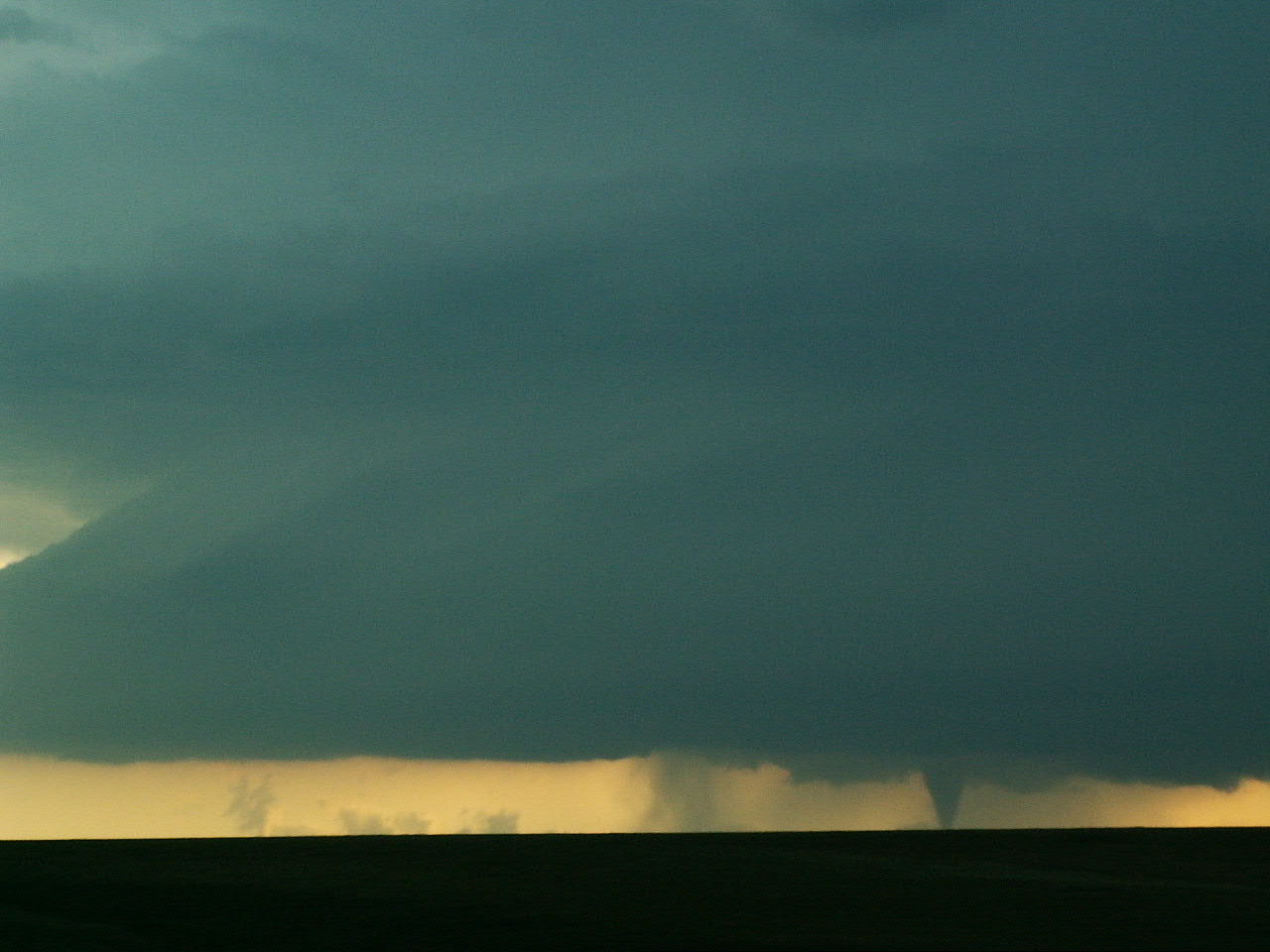
Can you see it? Unlike it’s earlier counterpart, this TORNADO was rain wrapped. For the Travis Lutzes of the world, a rain wrapped tornado is like a burrito, with a rain curtain tortilla shell and a soft, squishy tornado center (perhaps contrary to popular belief, tornadoes don’t actually coexist well with rain. While it is believed that the cold air generated by precipitation is necessary for the formation of many tornadoes, tornadoes are essentially areas of violently rotating, upward moving air. Rain and other precipitation cools the surrounding air, causing downward motion. As you may have already deduced, downward motion isn’t too conducive to upward motion, and so tornadoes in the immediate vicinity of rain don‘t usually fair too well… In any event, the rain wrapped tornado we saw did not last very long).

Sadly, both of these tornadoes occurred in the middle of what we like to call a road hole, and since Vortex2 vehicles have a great history of getting stuck in the mud when they so much as pull off the road and onto a wet grassy shoulder, the CSWR Pod People were unable to deploy any pods in the tornado’s path. Also sadly, the storm shortly thereafter turned into little more than another RCC (Really Cool Cloud)… very nice to look at, but not much of a tornado threat. Oh well, there are still a few days left, right?


Following the TORNADOes and subsequent RCC, on the way back to our sleeping establishment for the evening, we were treated by mother nature to a spectacular lightning show, complete with a couple very high based little funnel clouds:


Can you see those?

On June 11, 2010 (a Friday, named after and sacred to the Norse goddess Freya), we saw some more TORNADOes, but they were pretty weak and short lived. I was sitting in the back seat of Probe13 when those happened. No pictures ensued. I did, however, manage to catch this shot of a small herd of the ellusive Imaxis filmcrewia and their mobile dwelling at a Colorado watering hole. (Props to Mike (who is not looking at the camera), Darren (who is not looking at the camera), Jack (who is behind a camera and not looking at the camera), and Greg (who is actually looking in the general direction of the camera).)

Monday, June 7, 2010

The Search Continues…

Tornadogenesis failure. Two words that have plagued the Vortex2 armada this past weekend. All looks well, clouds are rotating, we think something might actually develop and then… nothing. Nothing at all. It makes us sad pandas. Very sad pandas…

The Vortex2 project has been operating under the “we will sacrifice sleep (and breakfast *sob*) for tornadoes!” mantra for the past couple of days, and with glorious results. We have seen fabulous RCCs (really cool clouds), and these RCCs really have looked like they might just become tornadic; but alas the weather has continually failed us. Yours truly has been largely breakfastless for the past couple of days as we’ve driven hours upon hours and chased mesocyclone after mesocyclone (I may be exaggerating, but only a little) only to find that our beautiful storms quickly become outflow dominant and just plain yucky (on radar) when we arrive to observe them. The tornadoes we like (ie not gustnadoes) don’t like outflow. Bummer.

On a plus note, these people with fancy cameras (I hear they’re filming for this thing called IMAX) asked Vortex2 if they could take some levitating airborne vehicle called a helicopter and film us as we were leaving Omaha, Nebraska this morning after I was mercilessly barred from completing my breakfast. It was pretty cool (the helicopter, not being forced to abandon my pineapple mid chew). I should’ve put my game face on…


The helicopter and NOXP, the super cool dual-polarization mobile radar home of one Dr. Don Burgess (he likes Dairy Queen), as seen from the bug splattered, cracked windshield of Probe 13.


RCC #2 of the day. Mesocyclone: to the left. Haze of dirty Probe 13 back seat driver’s side window: in the front. Tornado: nonexistent.


This bit in the middle that looks like it might be forming a tornado is indeed not a tornado. This sneaky little thing is a scud cloud. Scud clouds are IMPOSTERS. They only want to make you think they’re tornadoes. Like those non venomous red, black, and yellow banded snakes that look like other venomous red, black, and yellow banded snakes. Yeah, just like that. Those jerks.


Some whole wheat for a balanced diet.

An extra little note: Tornadogenesis failure data isn't all bad. Actually, one can say it's pretty good data to have. If we can figure out why tornadoes don't form when we think they will, that may bring us one step closer to figuring out why they form when they do. Hooray! Science rocks!

Tuesday, June 1, 2010

Have You Seen Our Tornadoes?

This has got to stop! (Bonus points if you get that reference.) Vortex2's stint of wait and miss continues. Our most recent blunder occurred on Monday, May 31. Yes folks, Memorial Day. While much of America was probably grilling out and getting corn on the cob stuck between their front teeth, Vortex2 was in North Platte, Nebraska, waiting for the call to either go chase or ferry to the next hotel. Chances of (good) convection seemed small and rather far away that day (much further than poor ol' DOW 5 could ever dream of going with the blown out tire and transmission it recently acquired), so we were directed to head to the next hotel early in the evening.

A gruesome sight awaited us at our destination hotel. Upon entering one Holiday Inn in Kearney, Nebraska (which was a very nice hotel, by the way), much of Vortex2 was forced to view a horrific scene playing on the Weather Channel in the hotel lobby... the day's tornado, streaming live onto a 42+ inch LCD television, taking place in southeastern Colorado (the far away place where a slight chance of convection was predicted). The shock. The horror. The meteorologists aghast and dismayed. Tears were shed (on the inside) and outcries were made (not so much on the inside). The disappointment had to be put to rest. We had to move on.

When morning came, a decision was made by the PIs (ie big important people in charge) that we ought to take more advantage of these slight chances of storms that we have (ie sleep will become less or a priority in the remaining days of this project). The PIs made good on this decision today, and had us chasing (or waiting in a gas station parking lot) for the better part of the daylight hours. Unfortunately, the weather refused to cooperate, and instead of making lovely little discrete supercells for our enjoyment and research pleasure, it produced storms that quickly combined and became a big blob of weather nastiness. These rainy monsters can give us RCCs (Really Cool Clouds), but rarely the kind of tornadoes we want (because they're too rainy!). Tomorrow is a new day, perhaps the weather will be more kind (I hope it will be, because I am not horribly keen on having my bags packed and ready to go by 8:30am).

SASSI turtle says "Cheer up, it's not so bad." Hah. What do you know, SASSI turtle?


Probe 12, drives by a classic RCC. Congratulations on not breaking down today, 12! We're so proud of you.


ZOMG tornado!! We did see some tornadoes today! Well, sort of. This spinny dusty thing is probably a gustnado, which forms on a storm's gust front (ie the place where a storm's outflow meets the warmer environmental air). If the winds are right, and the storm's outflow is strong enough, the wind shear across the gust front can create these little gustnado vorticies. Since they're in contact with the ground and are underneath a cumuliform cloud, they're technically considered tornadoes, but since they're not the kind of tornadoes capable of transporting Dorothy to Oz, they're not really what we're looking for right now...